

Portfolio and Work Samples
(Please contact me to view larger originals)
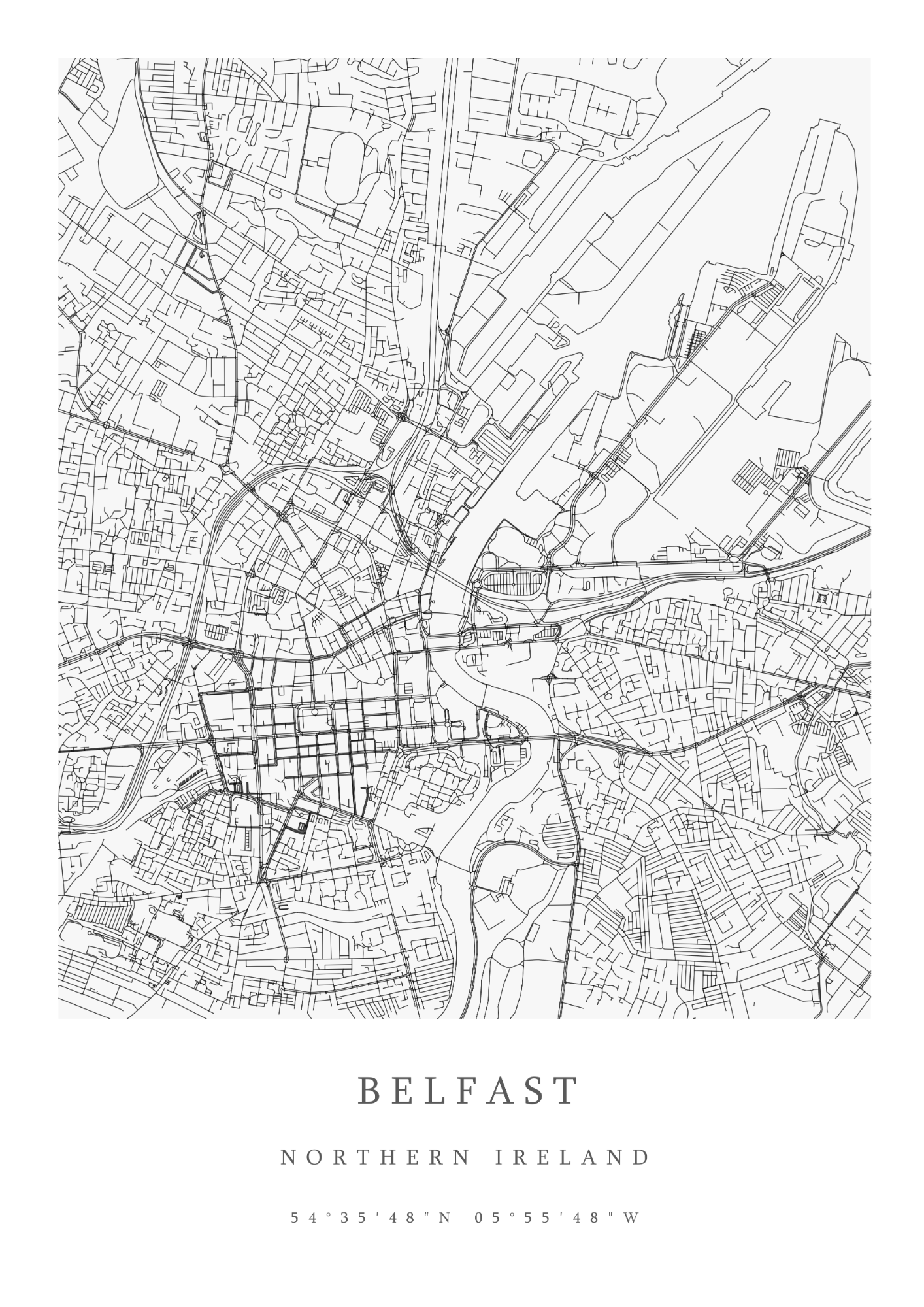
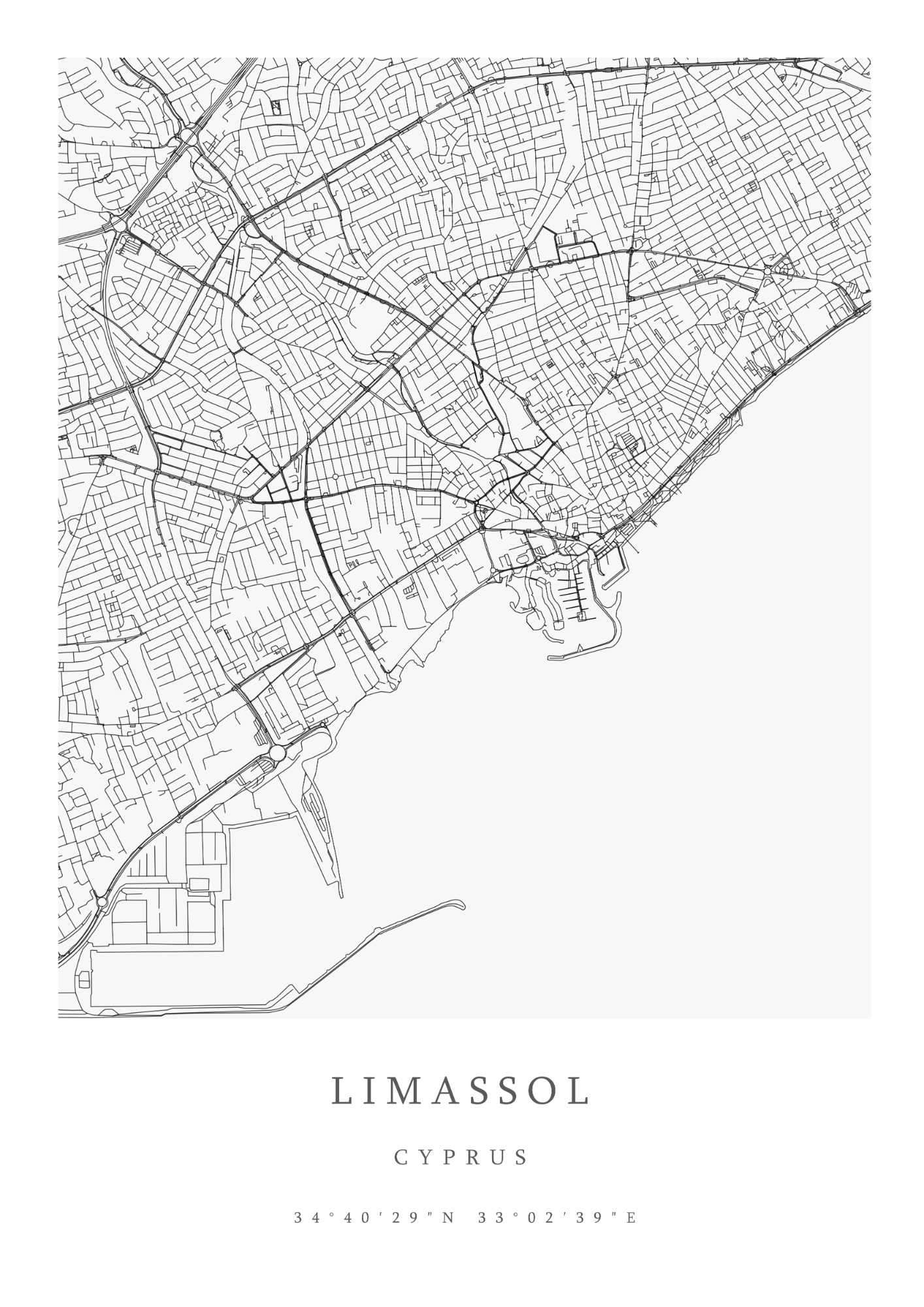
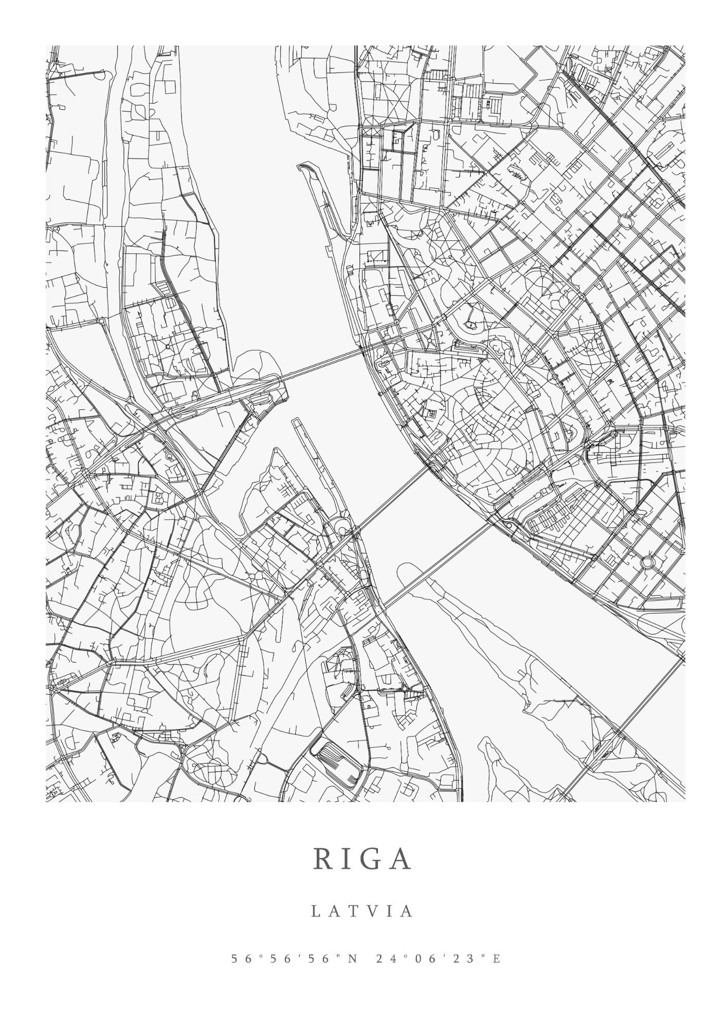
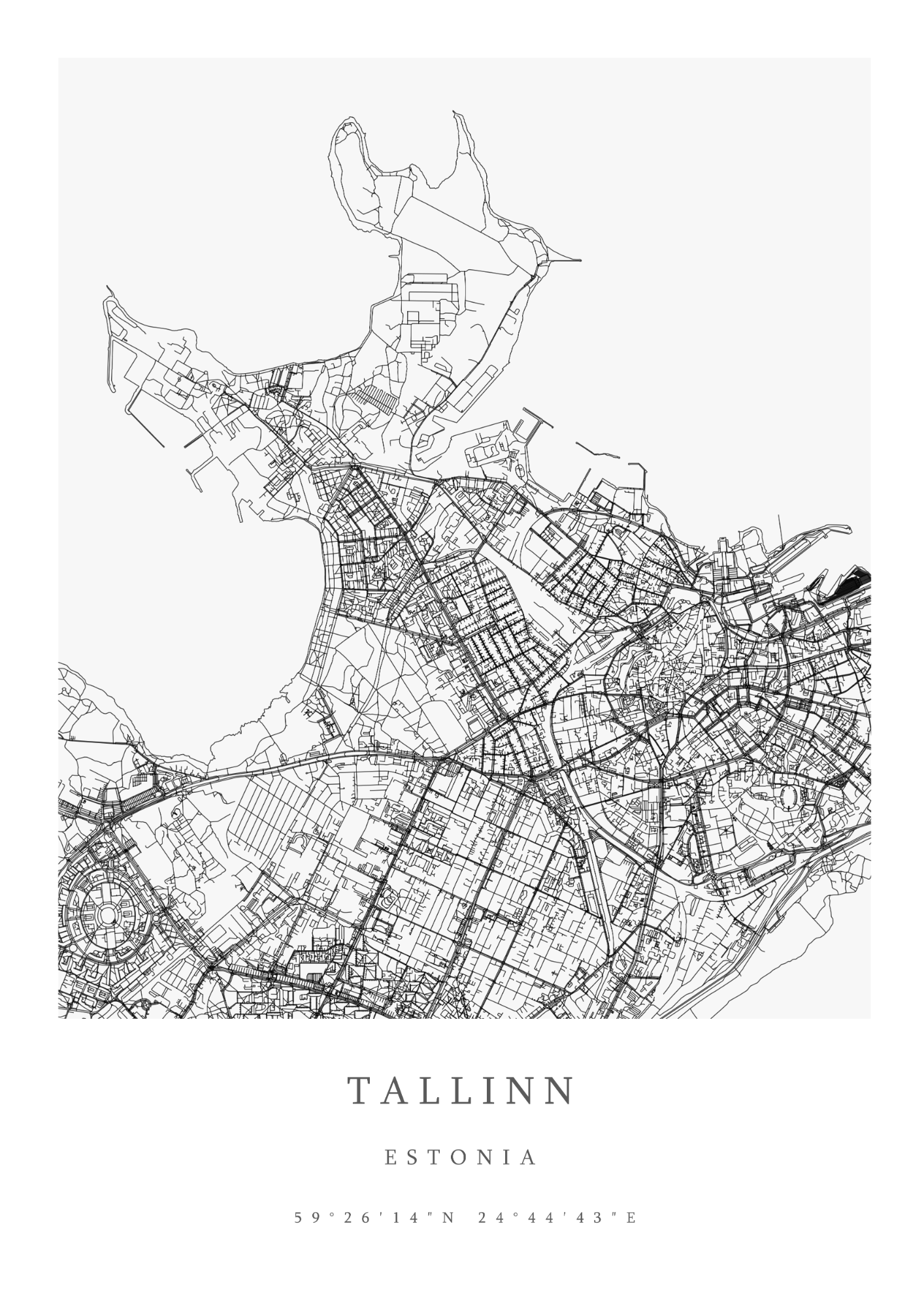
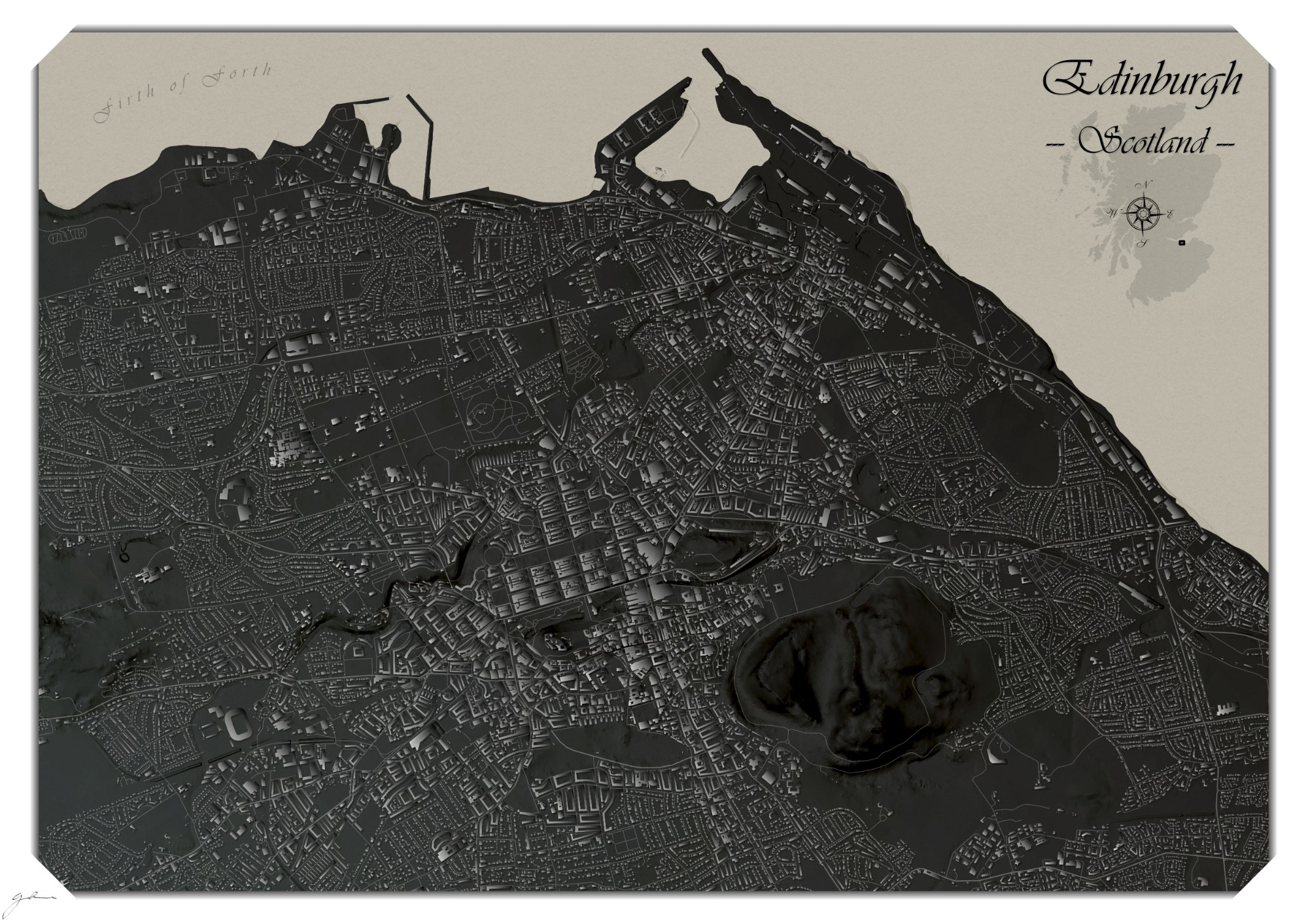
City Road Network Maps B&W
Simple, yet appealing street and road network maps designed for display on canvas, poster or as framed pictures.
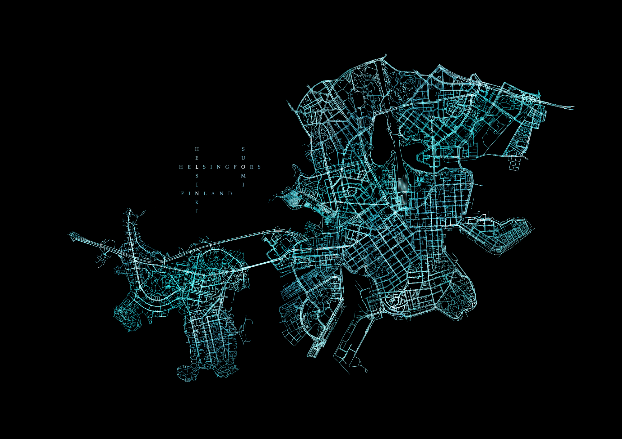
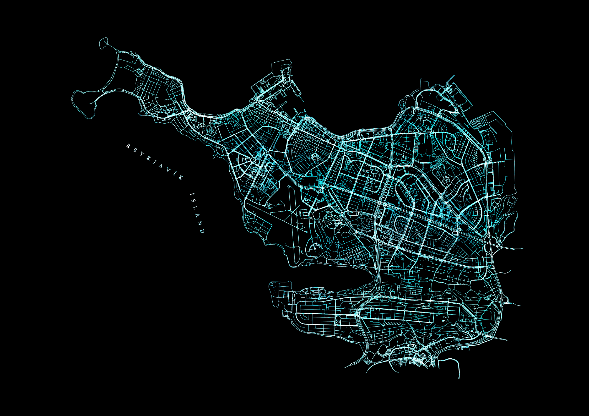
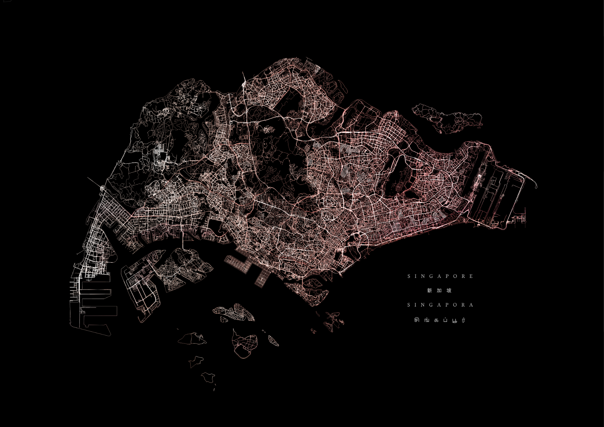
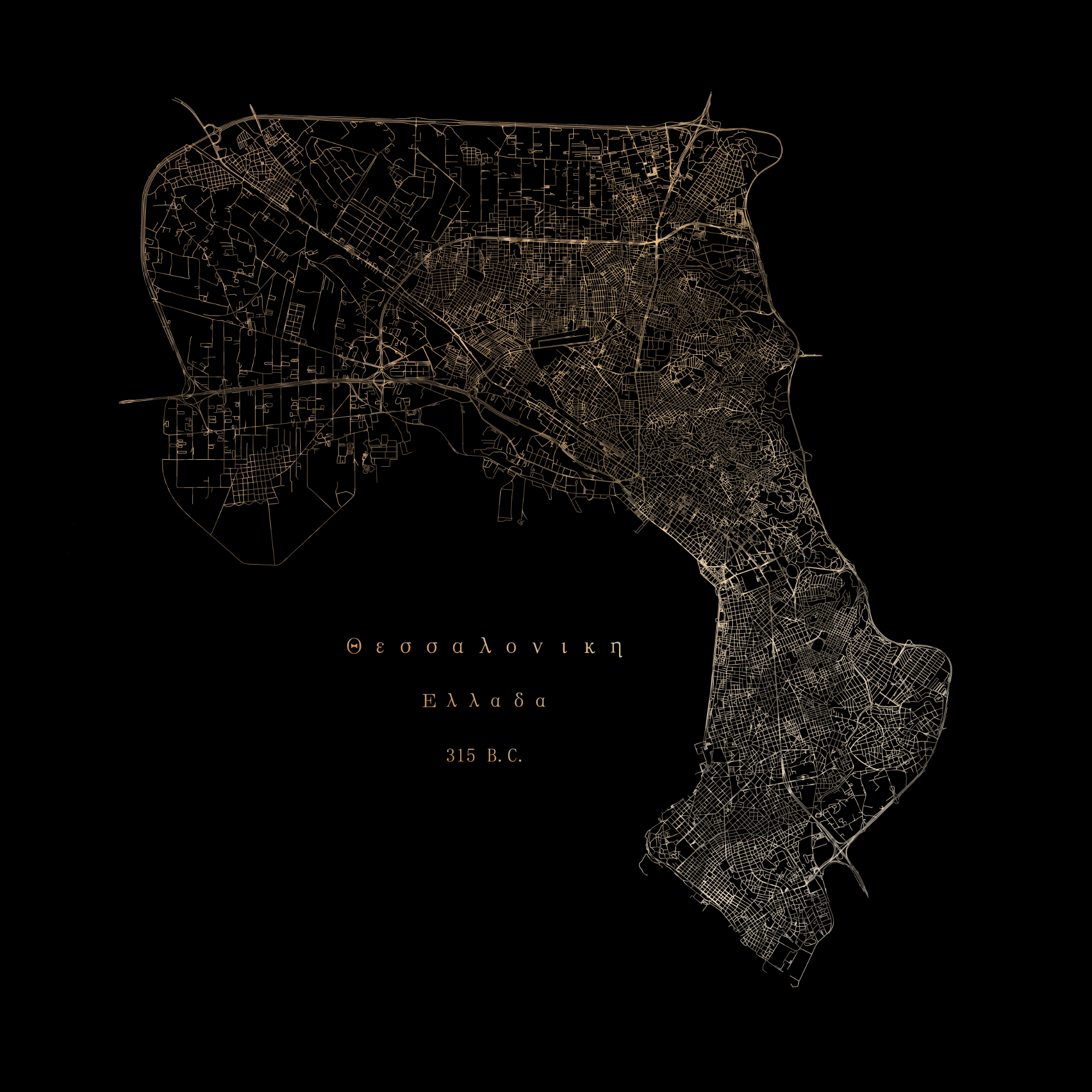
City Road Network Maps Colour
Designed with darker canvas displays in mind, these full-colour, customized pieces add greater depth and visual appeal to more traditional monochromatic road networks, whilst bringing out the under-lying road configurations that often go unnoticed and make each city unique.
Postcards and Cards
Smaller formats such as postcards and greetings cards are also well suited to appealing map designs.
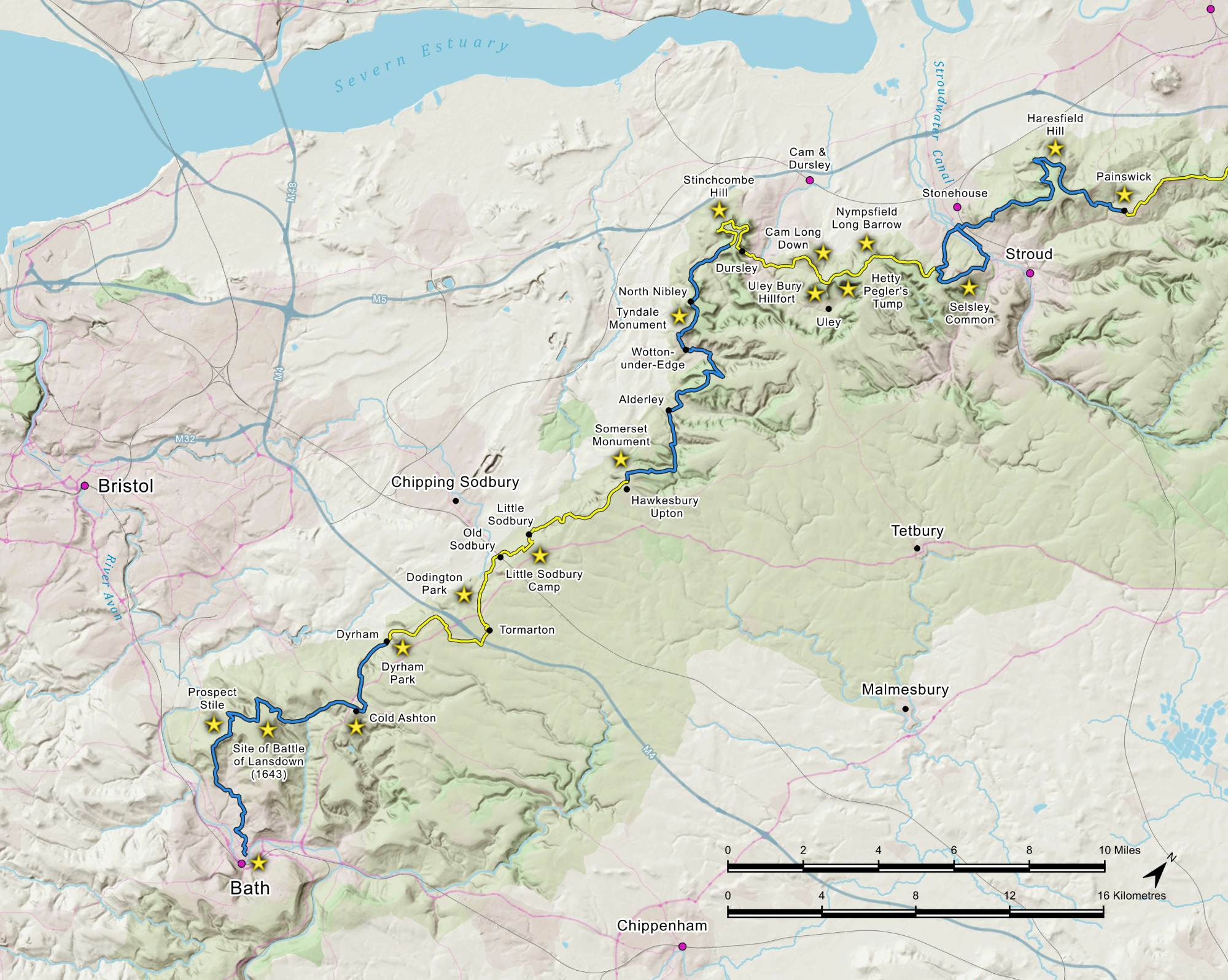
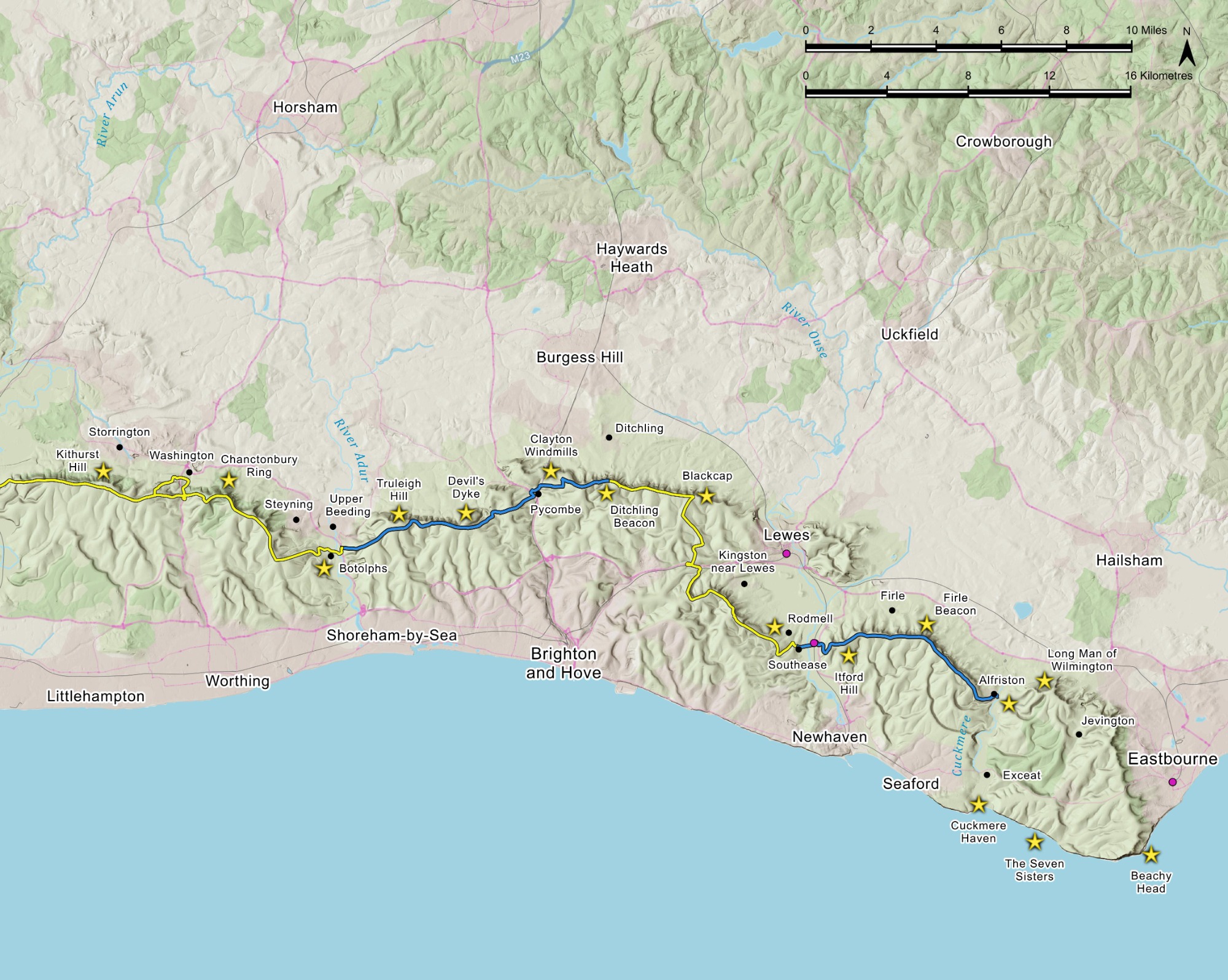
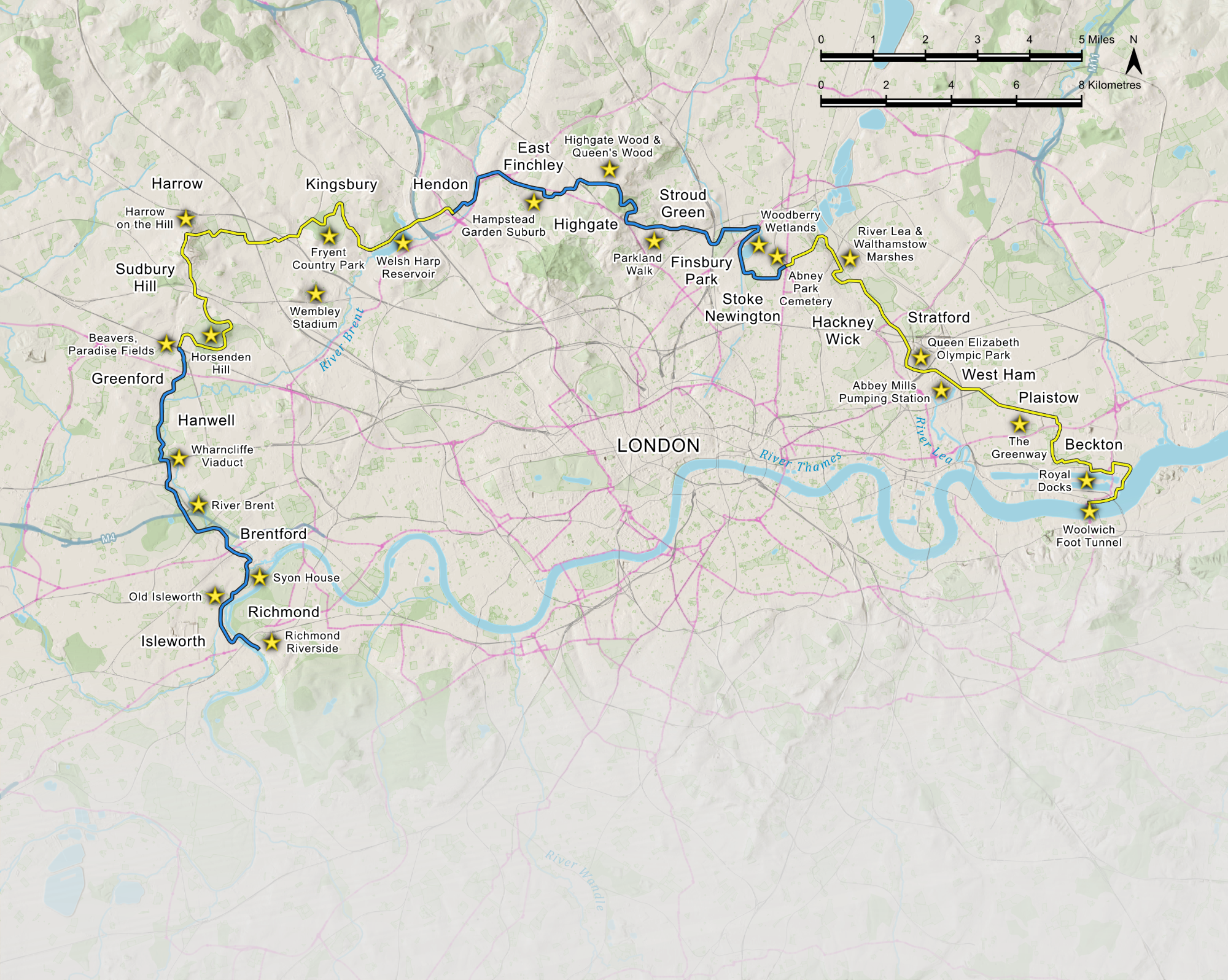
Sparky Books Walking Guide Work Samples
Bespoke national trail maps as featured in The Cotswold Way, South Downs Way and Capital Ring Sparky Walking Guides, amongst other titles in this series - all created using OS data under licence.
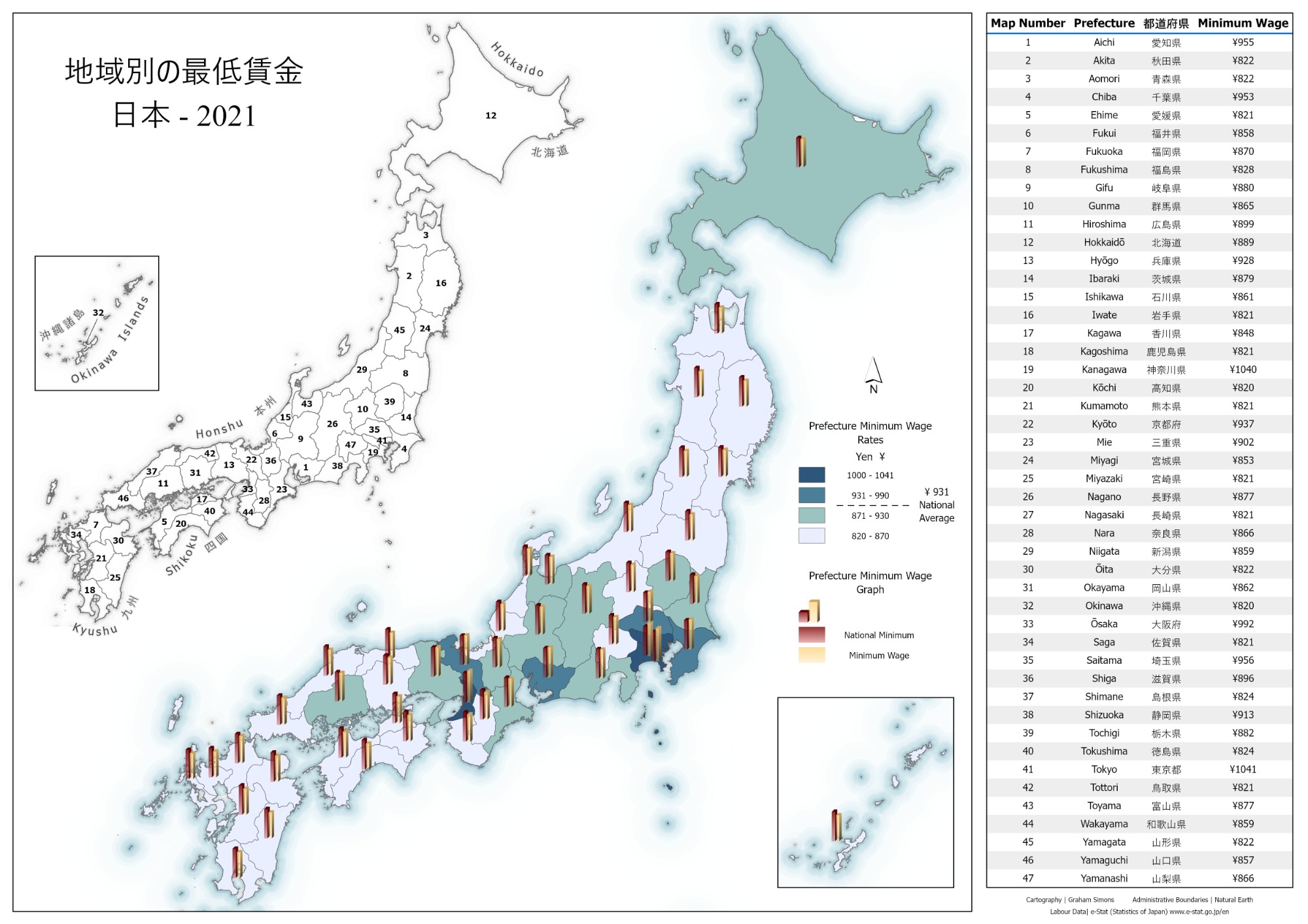
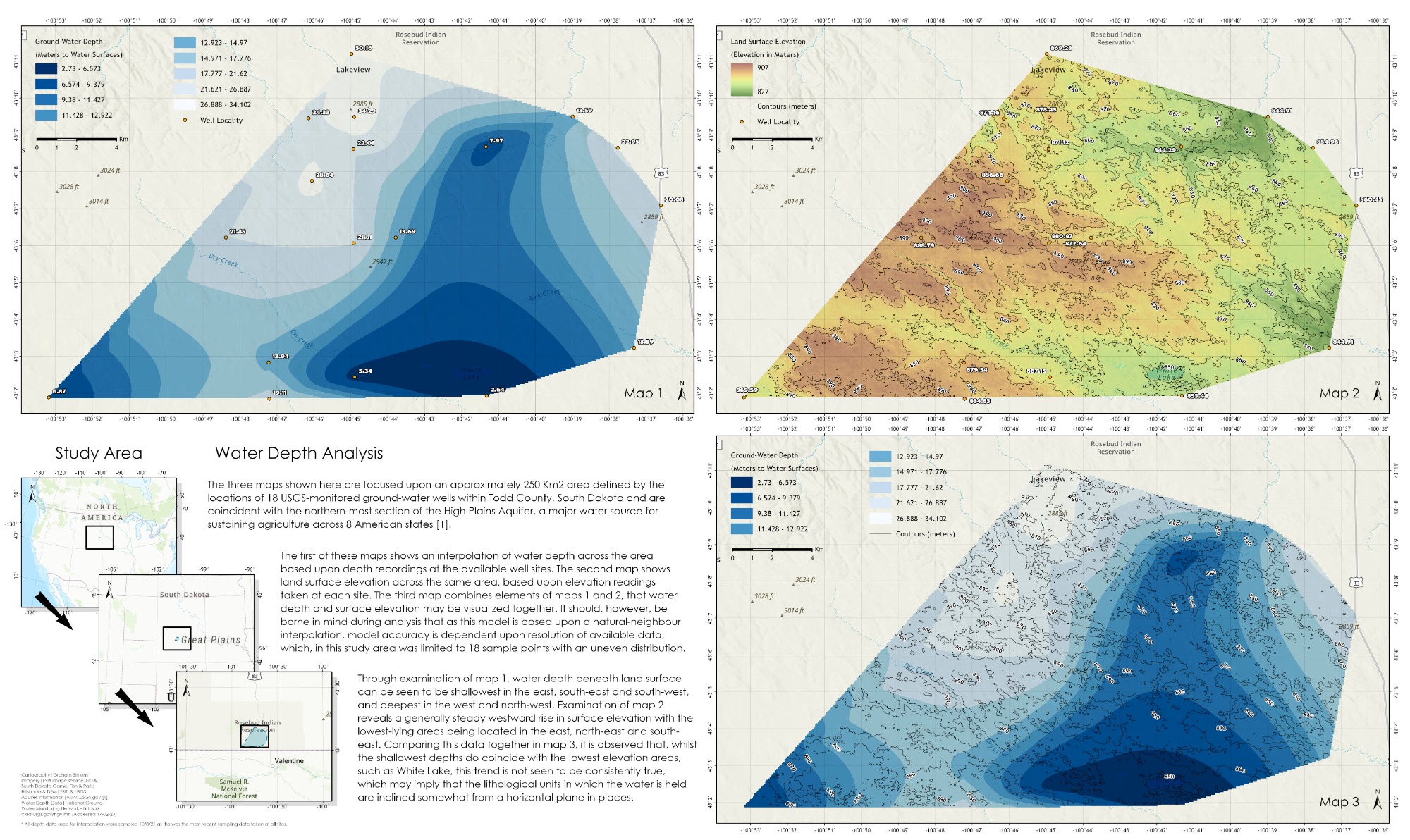
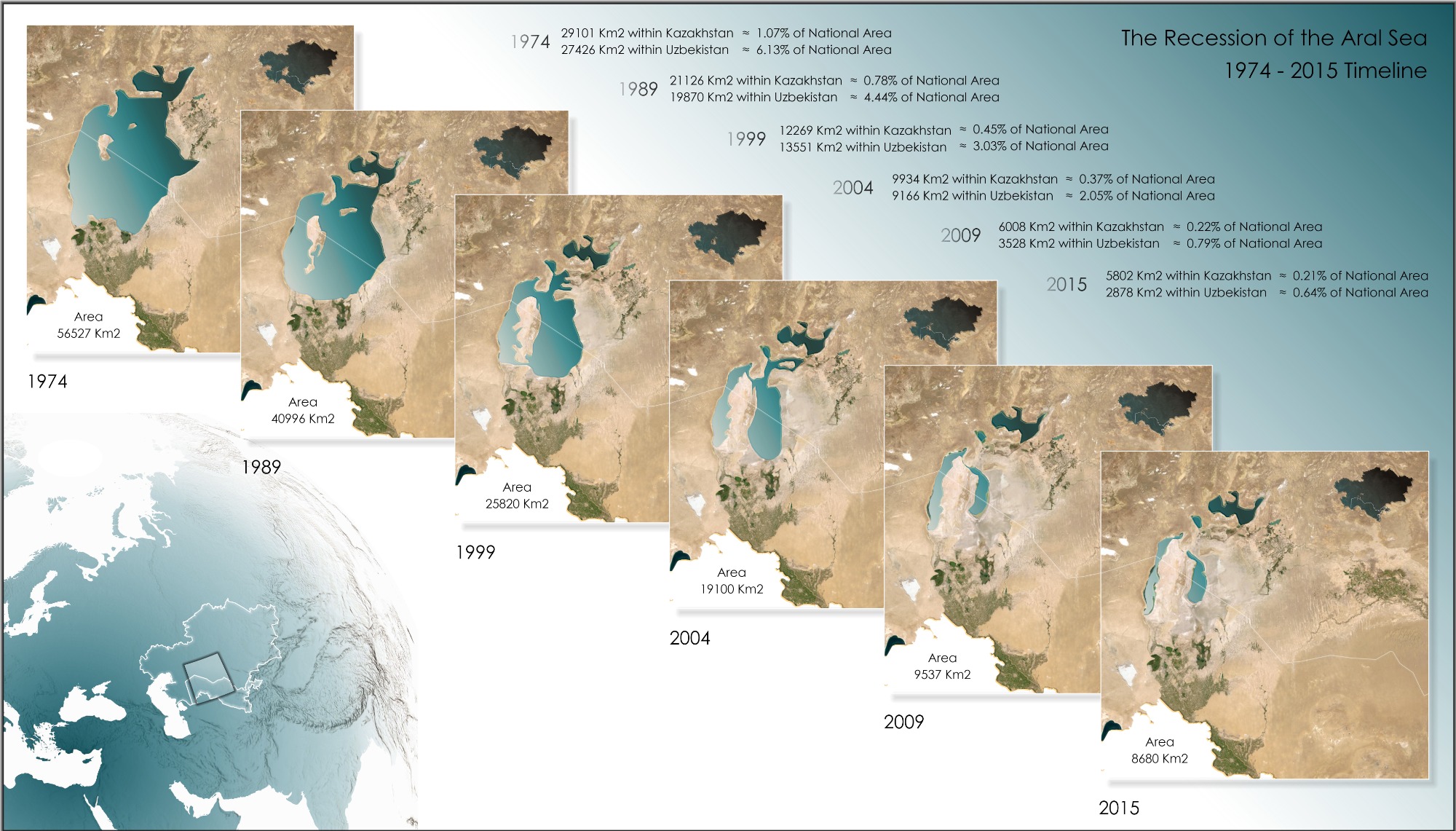
Data Visualization & Spatial Analysis
Maps designed specifically to aid visualisation, examination and understanding of geospatial data.
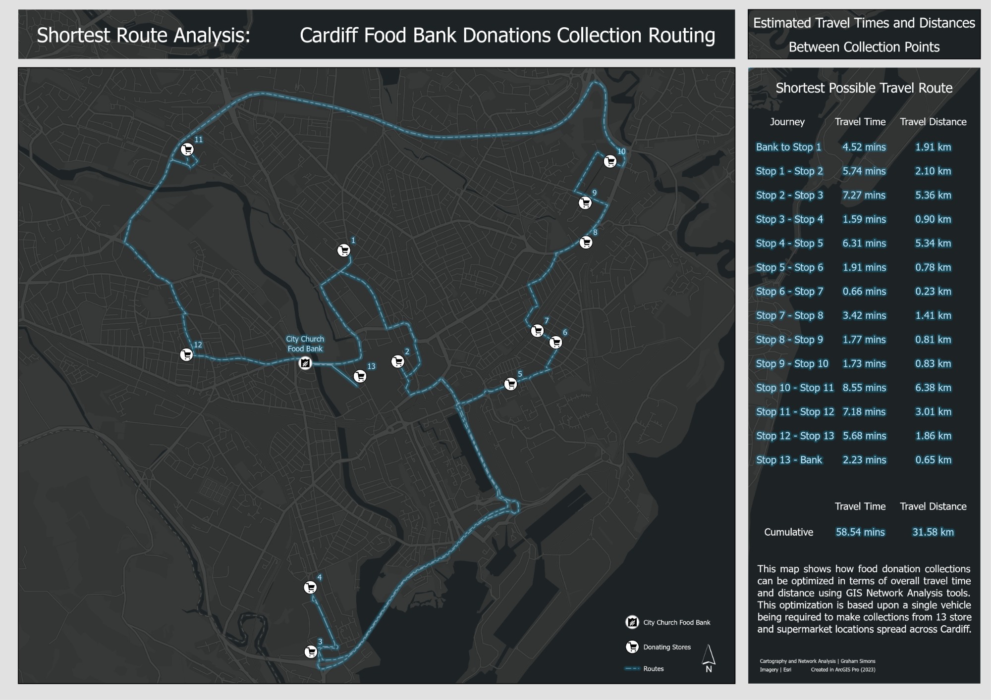
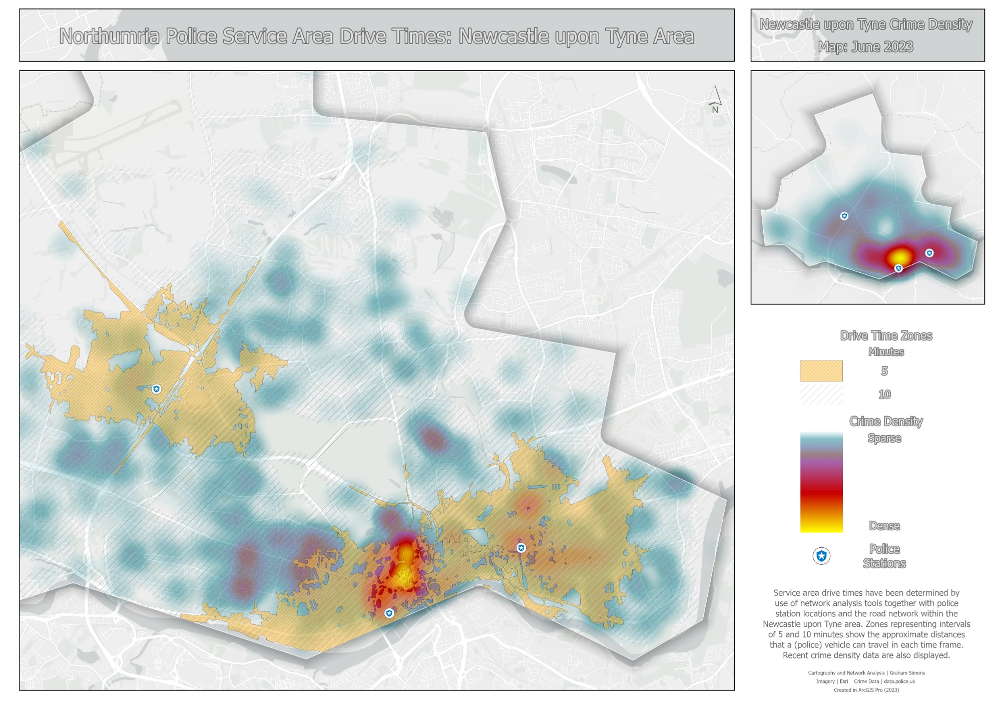
Network Analysis & Route Planning
Through the use of network analysis tools, these maps allow for route optimization and enhanced logistical planning.
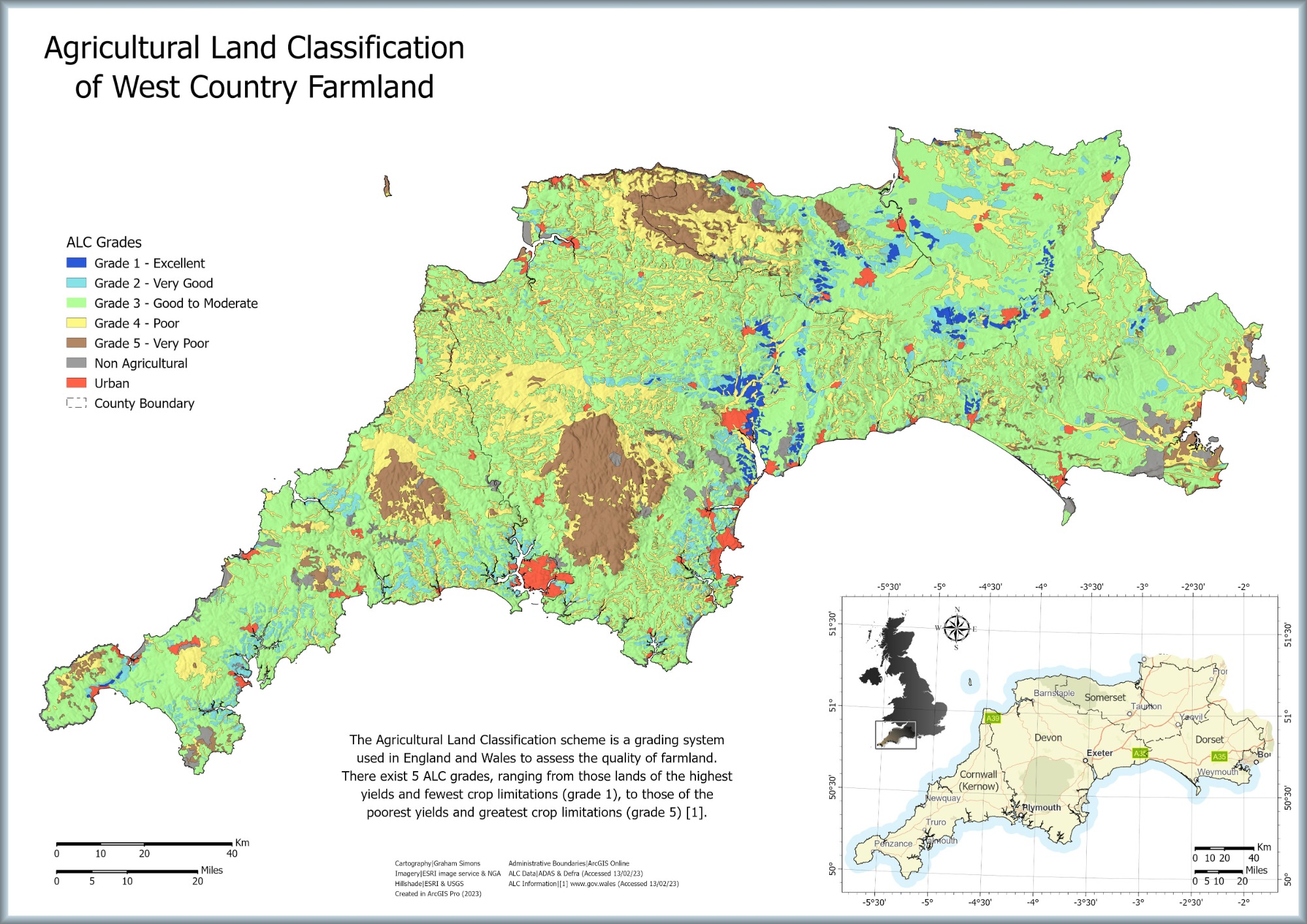
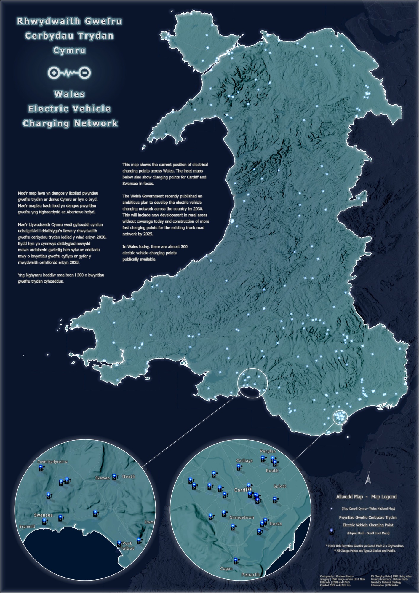
Poster Presentation
Whether combined with public transport routes, national statistics or environmental data, maps presented in poster format are an effective visual tool for conveying information.
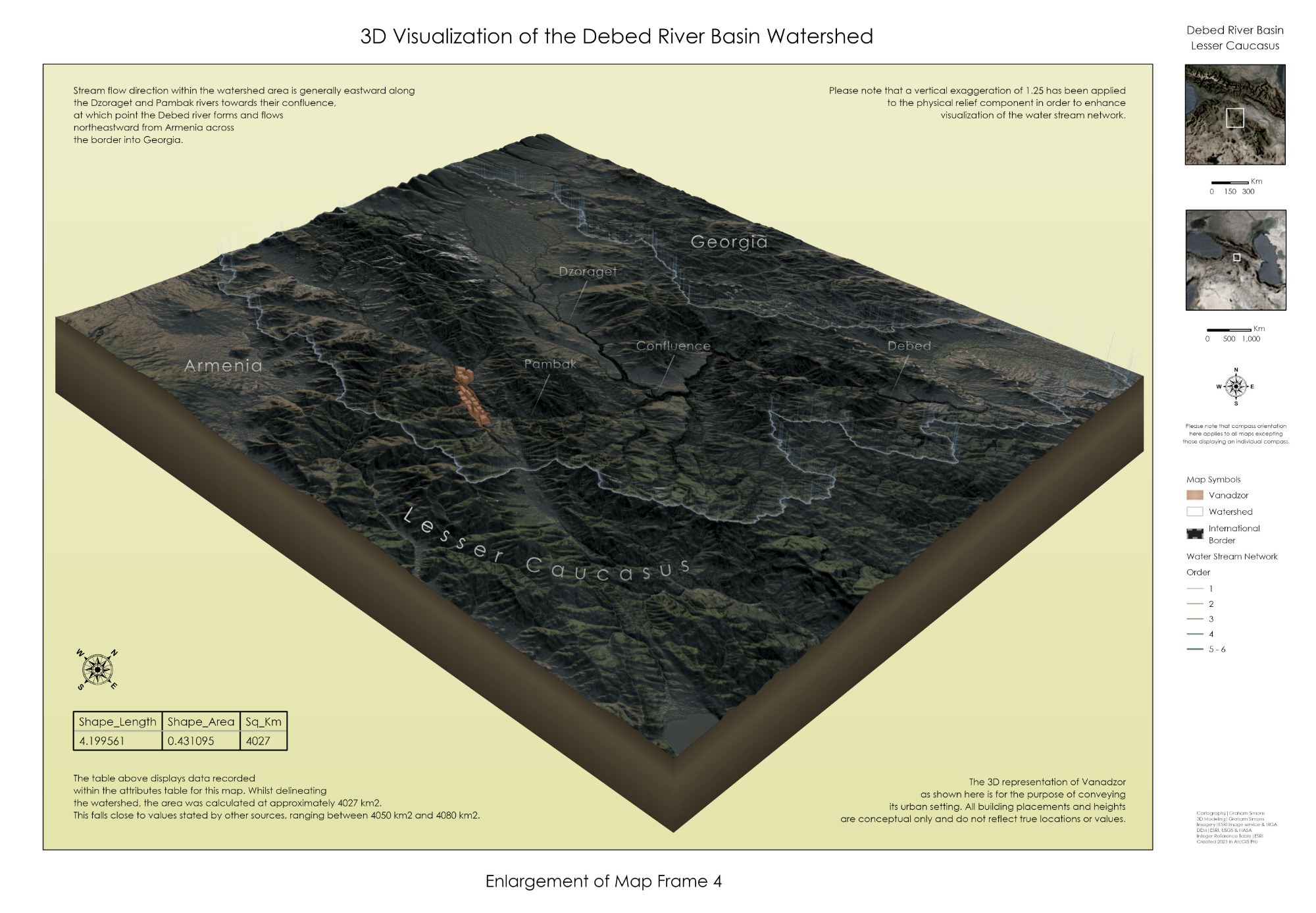
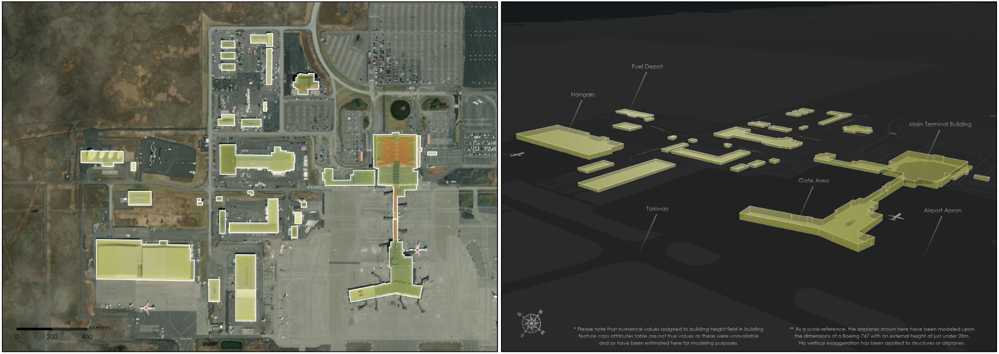
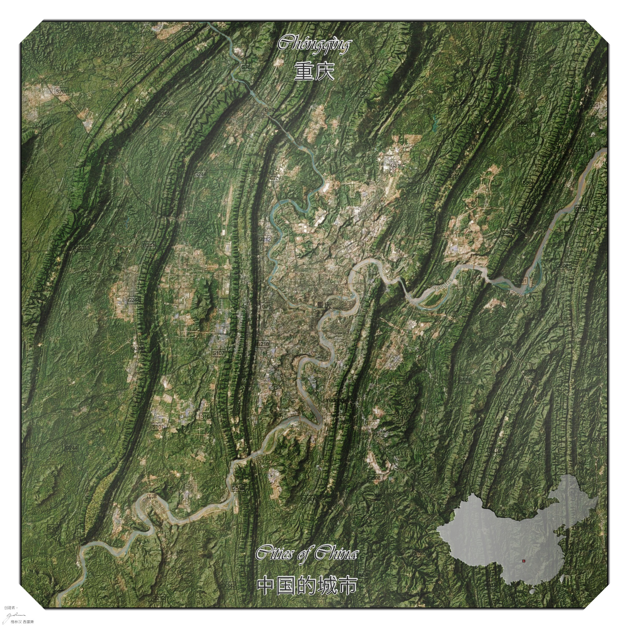
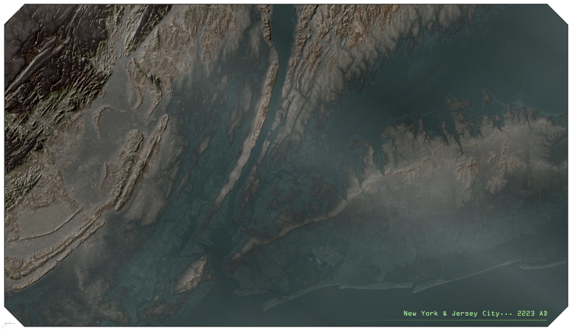
Topographic & 3D Maps
Utilizing a range of tools and techniques, these maps allow for enhanced and more striking visualization of geographic surface features, as well as the built environment.